Mosel Hike
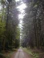
Day 2: Kobern to Treis-Karden
Mosel Hike
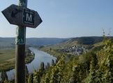
Day 6: Klüsserath to Trier6/29/02, 11:05a.m., at overlook above Longuich. Am eating an early lunch because it looks like rain - in fact just felt a drop. As I came here across the Mehringer Berg I got lost -- first time this hike. Probably went about 2 km out of the way. Will be leaving the Eifel Moselhöhenweg now and heading through Longuich to Ruwer, then to Trier.

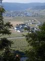

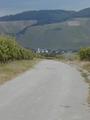
Looking back to Klüsserath - Ensch - Thörnich - Zitronenkreuz
12:45, Longuicher Sauerbrunnen. The water here does smell like sulphur, don't think I want to drink any. Another good place to camp. Made it back to the Moselhöhenweg, now on the Hunsrück side again. Had to take some short cuts straight down through vineyards on the left side of the Mosel to reach the bridge to Longuich. Longuich is similar to Klüsserath, small, not touristy, but with a few places to stay. Old, interesting-looking fortress in middle of town.

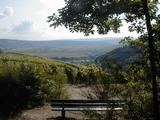
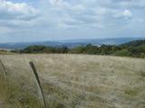
Longuich
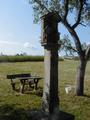
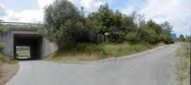
5:30p.m., Trier, sitting in the cathedral (Dom)-what a beautiful organ. I got here at 3:00 after exactly 30 km. (according to my GPS). The last 3-4 km from Ruwer to Trier were not particularly attractive, initially next to the road and then on a bike path (it's also possible to take a local bus from Ruwer to Trier). The little bit of Ruwer I passed through did not make me want to spend any more time there, although the Ruwer valley is supposed to be nice (and another wine-producing region). The trail to Ruwer from Longuich, however, is quite nice, through fields and forest.

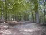
Trail to Trier
When I got to Trier, I went first to the tourist info center near the Porta Nigra and got a list of hotels. Most are pretty pricey, especially the ones right downtown. I decided to try 2 moderately priced hotels near the train station. The first had no vacancies but the second, Hotel Hochwald had a single for 33 E. About as run down a place as the hotel I stayed at in Klüsserath.

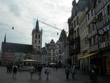
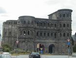
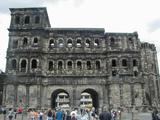

Trier: St. Paulin - Hauptplatz - Porta Nigra - Dom
Total distance today: 19 km
